– accurately, quickly, and without contact.
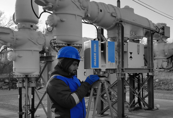
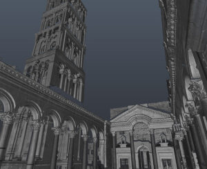
3D laser scanning is a non-contact measurement method designed to capture geometric data from complex and hard-to-reach surfaces. With the help of a 3D scanner, all visible surfaces are automatically measured, and the measurement results are converted into 3D models, 2D plans, or databases adapted to the specific requirements and wishes of the end user through indirect computer processing.
The technology can be described in layman’s terms as “freezing” the state of an object at a given moment and transferring this state into digital form – digitizing data about the shape of the object. The user can then virtually enter the digital model and obtain metric and visual spatial information.
Areas of application
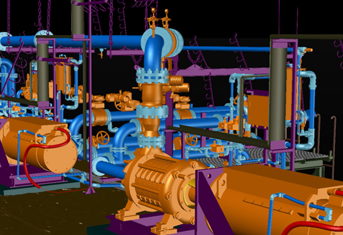
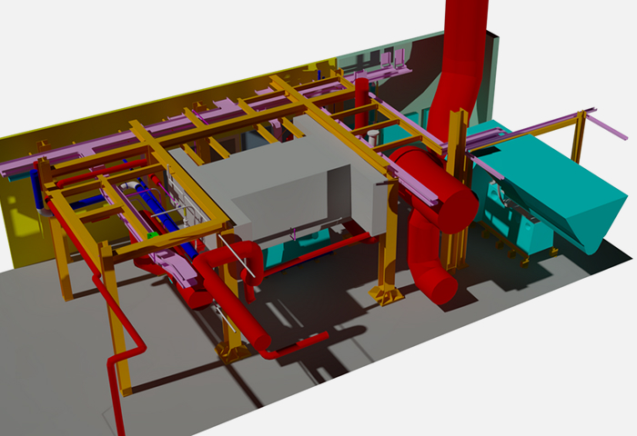
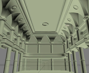
• As-built documentation / Existing conditions survey – preparation of accurate 3D models of existing buildings, structures, and infrastructure for planning, renovation, or integration into BIM.
• Inspection and quality control – verification of whether the construction complies with the plan, detection of deviations, errors, or collisions between the planned and actual construction.
• Volumetry and topographic measurements – calculations of volumes, areas, and accurate measurements of terrain, slopes, and relief; useful in mining, earthworks, and urban planning.
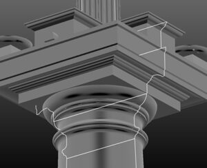
• Reverse engineering – creation of digital models of existing physical objects so that they can be reconstructed, upgraded, analogously reproduced, or used for production.
• Creation of digital twins – development of accurate and up-to-date digital copies of objects and systems for monitoring, maintenance, simulation, and optimization of operations.
Advantages of 3D laser scanning:
Exceptional accuracy – millimeter-precise data capture even on the most challenging surfaces.
Speed of execution – complete overview of the object in a few hours, without lengthy measurements.
- Non-contact technology – safe, touch-free measurement, suitable for sensitive or hazardous objects.
Comprehensive data capture – one-time scanning, endless possibilities for analysis and modeling.
- Wide applicability – from architecture and construction to industry, infrastructure, and cultural heritage.
Who uses the results of TLS measurements?
- Architects and designers – detailed plans, renovations, and digital models of the existing situation.
- Construction and engineering companies – construction control, collision detection, volume and deformation calculations.
- Surveyors – topographic measurements, surveying plans, and integration into GIS systems.
- Infrastructure managers – monitoring the condition of structures, maintenance planning, and long-term management.
- Industry and cultural heritage – reverse engineering, digital twins, documentation, and preservation of historical structures.
Our 3D laser scanning products
- Point Cloud – comprehensive high-resolution spatial capture as a basis for further processing.
- 2D Plans – accurate floor plans, sections, and facades of existing buildings.
- 3D Models – realistic digital models for visualization and technical processing.
- BIM models – intelligent digital models with all the information needed for planning, construction, and management.
- Digital twins – virtual copies of buildings and systems for monitoring, simulation, and optimization.
- Analyses and reports – volumetry, deformations, deviations, and collisions for accurate assessment of the situation.
Latest projects